Property Record
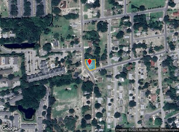
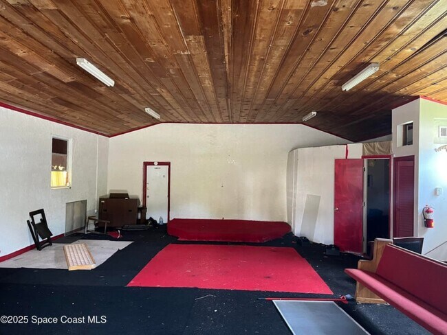
929 S Deleon Ave, Titusville, FL 32780
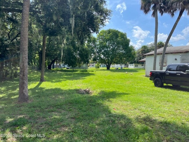
This Property Is For Sale
NEARBY LISTINGS FOR SALE OR LEASE
-
-
View all Titusville listings for sale on LoopNet.com
Property Detail
929 S Deleon Ave
Palm Bay-Melbourne-Titusville, FL
Rerdells Addn To Titusville
22-35-03-51-00000.0-0110.00
RERDELLS ADDN TO TITUSVILLE LOTS 110 & 111 EX E 36 FT & RD R/W
Religious
Brevard
X
Florida
12009C0205H
110
2024
0.25 AC
2025
Brevard County
060700
Orlando
1,280 SF
DEMOGRAPHICS near 929 S Deleon Ave
1 Mile
3 Mile
5 Mile
2024 Total Population
8,907
39,243
61,487
2029 Population
9,631
42,261
66,072
Pop Growth 2024-2029
+ 8.13%
+ 7.69%
+ 7.46%
Average Age
41
44
44
2024 Total Households
3,837
16,989
26,204
HH Growth 2024-2029
+ 7.79%
+ 7.46%
+ 7.20%
Median Household Inc
$44,057
$61,184
$67,071
Avg Household Size
2.20
2.20
2.30
2024 Avg HH Vehicles
2.00
2.00
2.00
Median Home Value
$300,356
$302,361
$294,278
Median Year Built
1979
1981
1982
Nearby Places
Map Layers
Map Styles
 Street
 Aerial
- Restaurants
- Banks
- Shops
- Fitness
- Groceries
PUBLIC TRANSPORTATION
AIRPORT
Orlando Sanford International
DRIVE
WALK
Distance
Orlando Sanford International
67 min
46.3 mi
Freight Ports
Port Canaveral
DRIVE
WALK
Distance
Port Canaveral
36 min
24.0 mi
Nearby Properties
Address
Land Use
TOTAL SIZE
Lot Size
Zoning
Address
Land Use
TOTAL SIZE
Lot Size
Zoning
440,368 SF
60.44 AC
HM
Address
Land Use
TOTAL SIZE
Lot Size
Zoning
18,000 SF
16.54 AC
P
Address
Land Use
TOTAL SIZE
Lot Size
Zoning
381,629 SF
18.90 AC
Address
Land Use
TOTAL SIZE
Lot Size
Zoning
301,357 SF
23.86 AC
P
Address
Land Use
TOTAL SIZE
Lot Size
Zoning
172,172 SF
116.12 AC
P
Address
Land Use
TOTAL SIZE
Lot Size
Zoning
243,389 SF
29.15 AC
RC
Address
Land Use
TOTAL SIZE
Lot Size
Zoning
194,641 SF
5.02 AC
Address
Land Use
TOTAL SIZE
Lot Size
Zoning
267,207 SF
36.82 AC
P
Address
Land Use
TOTAL SIZE
Lot Size
Zoning
225,896 SF
19.01 AC
R3
Address
Land Use
TOTAL SIZE
Lot Size
Zoning
3.25 AC
P
Address
Land Use
TOTAL SIZE
Lot Size
Zoning
118,056 SF
11.52 AC
R3
Address
Land Use
TOTAL SIZE
Lot Size
Zoning
206,579 SF
15.90 AC
R3
Address
Land Use
TOTAL SIZE
Lot Size
Zoning
164,378 SF
12.45 AC
R3
Address
Land Use
TOTAL SIZE
Lot Size
Zoning
130,615 SF
16.15 AC
RC
Address
Land Use
TOTAL SIZE
Lot Size
Zoning
187,335 SF
5.92 AC
P
Address
Land Use
TOTAL SIZE
Lot Size
Zoning
141,654 SF
10.43 AC
R3
Address
Land Use
TOTAL SIZE
Lot Size
Zoning
95,198 SF
5.32 AC
R3
Address
Land Use
TOTAL SIZE
Lot Size
Zoning
59,953 SF
0.71 AC
Address
Land Use
TOTAL SIZE
Lot Size
Zoning
89,424 SF
15.31 AC
GU
Address
Land Use
TOTAL SIZE
Lot Size
Zoning
54,816 SF
10.11 AC
BU-1
Address
Land Use
TOTAL SIZE
Lot Size
Zoning
79,548 SF
4.89 AC
R3
Address
Land Use
TOTAL SIZE
Lot Size
Zoning
114,746 SF
28.29 AC
P
Address
Land Use
TOTAL SIZE
Lot Size
Zoning
163,141 SF
18.58 AC
P
Address
Land Use
TOTAL SIZE
Lot Size
Zoning
2,536 SF
75.81 AC
OR
Address
Land Use
TOTAL SIZE
Lot Size
Zoning
64,036 SF
2.45 AC
R3
Address
Land Use
TOTAL SIZE
Lot Size
Zoning
97,504 SF
14.70 AC
OR
Address
Land Use
TOTAL SIZE
Lot Size
Zoning
100,006 SF
12.32 AC
P
Address
Land Use
TOTAL SIZE
Lot Size
Zoning
121,859 SF
16.07 AC
R3/OR
Address
Land Use
TOTAL SIZE
Lot Size
Zoning
111,540 SF
6.83 AC
R3
Address
Land Use
TOTAL SIZE
Lot Size
Zoning
68,077 SF
13.60 AC
P
The World's #1 Commercial Real Estate Marketplace
Connect with us
© 2025 CoStar Group
The information above has been obtained from sources believed reliable. While we do not doubt its accuracy we have not verified it and make no guarantee, warranty or representation about it. It is your responsibility to independently confirm its accuracy and completeness. Any projections, opinions, assumptions, or estimates used are for example only and do not represent the current or future performance of the property. The value of this transaction to you depends on tax and other factors which should be evaluated by your tax, financial, and legal advisors. You and your advisors should conduct a careful, independent investigation of the property to determine to your satisfaction the suitability of the property for your needs.